Free Online Drone Surveying Courses and Certifications 2024
Drone surveying is the use of unmanned aerial vehicles (UAVs) to capture aerial imagery and data for surveying and mapping purposes. Drone surveying is used to create accurate 3D models of landscapes, buildings, and other objects, as well as to measure distances, heights, and other features. Drone surveying is becoming increasingly popular due to its cost-effectiveness, accuracy, and speed.
Popular Courses
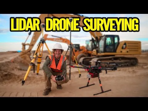
This course is perfect for anyone interested in learning more about LiDAR Drone Surveying and its accuracies and results. Participants will gain an understanding of the different types of LiDAR, the advantages and disadvantages of each, and the best practices for obtaining accurate results. They will also learn about data processing and analysis techniques used to generate accurate results and how to interpret the results. With the help of the ROCK robotic team, participants will be able to make informed decisions and get the most out of their LiDAR Drone Surveying. Sign up now and get the knowledge and skills you need to make the most of LiDAR Drone Surveying.
Learn MoreThis course is perfect for new learners who want to become professionals in drones for farming. It provides an in-depth look at multispectral drone cameras and their use in the agricultural market. Learners will gain knowledge on the basics of drone cameras and how to use them for vegetation imagery. Additionally, the course will cover the different lenses and filters used to capture the wavelengths of light that crops interact with throughout the growing season. Don't miss out on this opportunity to become an expert in Farm Drone Sensor Showdown.
Learn MoreThis Marlyn & Navigator - Starter training course is designed to equip new learners with the knowledge and skills necessary to operate Marlyn UAV and Navigator software. It covers topics such as VTOL, innovative software features, high wind resistance, advanced sensor fusion, and more. Learners will gain an understanding of how to use the Marlyn UAV and Navigator software to capture geospatial data with accuracy down to 1cm, fly in winds of up to 45km/h, and operate from any 2x2m area. Additionally, the course will help learners to reduce the number of people and equipment onsite and minimize waste of project resources, helping their firm reach its sustainability goals. Sign up now to learn how to use Marlyn UAV and Navigator software and make a difference in your firm's sustainability goals.
Learn MoreThis course series, The Ultimate Guide for Land Surveying with Drones - Part 3, has been a hit with over 4000 enrollments across 114 countries since its release 10 months ago. It is designed to teach new learners the end to end processes and techniques of using Ground Control Points (GCPs) for Land Surveying with Drones. Learn how to strategize, capture and process drone survey data with GCPs to obtain the highest amount of global accuracy in a drone mapping project. With positive reviews from its users, this course is the perfect way to get started with Land Surveying with Drones.
Learn MoreThis Ultimate Guide to Drone Applications-Construction Industry-1 course is the perfect way to learn how to use drones to increase accuracy, maximize efficiency and save costs in the first 5 stages of a construction project. With over 4000 enrollments from 114 countries, this course series has been a best seller on Udemy. It provides detailed information on how to use drones for site purchase decisions, land survey, site layout and architecture design, earthwork estimation and site activity inspection. Reviews from students have praised the course for its technical possibilities, depth of explanation and usefulness for civil engineers. Don't miss out on this opportunity to learn the latest drone applications in the construction industry.
Learn MoreThis Drone Surveying Course is the perfect way to get started in the field. It provides all the main theoretical information in a simple and fast way, covering the beginner level expectations. With this course, you will be able to understand the basics of drone surveying and generate reliable and high quality results. Plus, you can use the Q&A sections to ask more specific questions and get personalized answers from the instructor. Don't miss this opportunity to learn the fundamentals of drone surveying and take your skills to the next level.
Learn MoreThis course provides a comprehensive introduction to the use of drones for surveying. It is designed to give learners an understanding of concepts and best practices for drone deployment, data processing, and generation of 3D models and orthophoto mosaics. It also covers topics such as data acquisition, processing, and techniques for this emerging industry. Additionally, the course will discuss the importance of adhering to national and regional legislation and regulations, as well as the potential applications and limitations of UAVs. Professional guide for drone surveying is the perfect course for those looking to gain insight into the tremendous market opportunity for UAS-based photogrammetry and orthomosaic photography. Join now and learn the fundamentals of drone surveying!
Learn MoreThis Udemy course, "Introducing Drone Surveying", is perfect for anyone interested in learning the principles and techniques of drone surveying. It covers everything from the basics of drone surveying and its benefits, to more advanced techniques such as using RTK GPS and capturing thermal and multispectral data. Students will learn how to plan and execute a drone survey, process and analyze data, and generate reports and visualizations. In addition, the course also covers business and marketing aspects of drone surveying, such as building a business, identifying target markets, and developing marketing strategies. By the end of the course, students will have a solid understanding of drone surveying and how to apply it to real-world scenarios. Don't miss out on this exciting and rapidly evolving field - enroll now!
Learn MoreThis course is designed to teach you how to create and interact with digital models using open source software. You will learn to create 3D models from images using photogrammetry with drones, Regard3D, MeshLab, AutoDesk Recap, Bentley ContextCapture, generate point clouds, create surfaces in Civil3D, clean, thematize and export point cloud models, and share the model to the internet using SketchFab. With this course, you will be able to create digital models with Regard3D, clean point clouds with Meshlab, create 3D models from images with AutoDesk Recap, create digital models with Bentley ContextCapture, and open, thematize and export point cloud models with AutoDesk Recap. All materials and examples are included to help you replicate the practices.
Learn MoreThis course series, "The Ultimate Guide for Land Surveying with Drones - Part 1", is the perfect way to learn the basics of land surveying and how drones have revolutionized the process. With over 4000 enrollments across 114 countries since its release 10 months ago, this course has been a bestselling course on Udemy. It covers all the steps involved in flight planning and execution, and how to process the images captured to get the needed outputs. Reviews have praised the course for its clear, concise, and fun teaching style, making it ideal for beginners with no experience in drone surveying. Don't miss out on this opportunity to learn the essentials of drone surveying and get your first paying customer!
Learn MoreThis course is the second part of the 3 course series “The Ultimate Guide for Land Surveying with Drones”. It covers the steps involved after processing drone survey images, including post processing with software applications such as QGIS, AutoCAD, Google Earth Pro and Gimp. It also teaches how to create the best reports for clients and how to turn the knowledge into a profitable business. With over 4000 enrollments across 114 countries since its release 10 months ago, this course is a must for anyone who wants to do more than just process drone images. Reviews praise the course for its visuals, technical detail and use of open source software. Don't miss out on this opportunity to learn the skills to make your drone survey business successful.
Learn MoreLearn the basics of Drone Surveying Course: Professional Aerial Mapping Course (2020)
Learn MoreLearn the basics of Drone Mapping & Surveying Beginner Course
Learn MoreExplore the essentials of 5 Drone Industries That Will EXPLODE In 2023!
Learn MoreGet a comprehensive overview of I MADE $93,715 IN 6 MONTHS with my Drone - Drone Photogrammetry
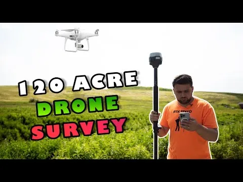
Learn MoreDiscover the fundamentals of I Surveyed 120 Acres with a Drone
Learn More Frequently Asked Questions and Answers
Q1: How much can you make drone surveying?
As of Sep 14, 2023, the average hourly pay for a Drone Surveying in the United States is $23.68 an hour.
Q2: How much does the average drone survey cost?
The average cost of drone land surveys varies depending on several factors. It can range from $75 to $150 per hour, and in certain instances, charges may be applied per acre, with potential costs falling between $50 to $500 per acre.
Q3: Is drone surveying profitable?
The report reveals that the surveying and mapping industry emerges as the most profitable segment among all others, despite not being the largest. Within the top 10 drone services generating annual revenues exceeding $100,000, surveying/GIS/mapping services claim the first position, closely followed by aerial photography and video.
Q4: What are the pros and cons of drone surveying?
While drone surveying offers numerous advantages, such as faster data collection, increased accuracy, and improved safety, there are also some downsides to consider. One of the main disadvantages of drone surveying is the high cost associated with this technology.
Q5: What Drone Surveying courses can I find on AZ Class?
On this page, we have collected free or certified 27 Drone Surveying online courses from various platforms. The list currently only displays up to 50 items. If you have other needs, please contact us.
Q6: Can I learn Drone Surveying for free?
Yes, If you don’t know Drone Surveying, we recommend that you try free online courses, some of which offer certification (please refer to the latest list on the webpage as the standard). Wish you a good online learning experience!
