ArcGIS Platform 
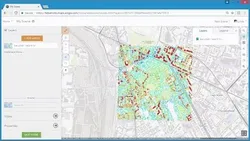
ArcGIS Platform from Esri provides a comprehensive and high-quality set of location services, data, and mapping tools. It enables users to integrate location into their apps and business systems, allowing them to take advantage of market-leading location services as a platform as a service (PaaS). ▼
ADVERTISEMENT
Course Feature
![]() Cost:
Cost:
Free
![]() Provider:
Provider:
Youtube
![]() Certificate:
Certificate:
Paid Certification
![]() Language:
Language:
English
![]() Start Date:
Start Date:
On-Demand
Course Overview
❗The content presented here is sourced directly from Youtube platform. For comprehensive course details, including enrollment information, simply click on the 'Go to class' link on our website.
Updated in [February 21st, 2023]
Esri's ArcGIS Platform brings market-leading location services to you as a platform as a service (PaaS). Integrate location into your apps and business systems with the most comprehensive and high-quality set of location services, data, and mapping tools available. Build with the mapping libraries of your choice or use Esri's full range of mapping libraries and no-code options that reduce time to market and promote creative design.
ArcGIS Platform offers an affordable and flexible location-focused PaaS for software developers, businesses, and organizations that need to bring location innovation into their products, solutions, and systems.
Learn more about ArcGIS Platform sign up for free here: http://ow.ly/HbeY50FPFT0
(Please note that we obtained the following content based on information that users may want to know, such as skills, applicable scenarios, future development, etc., combined with AI tools, and have been manually reviewed)
1. Comprehensive Location Services: Learners can obtain comprehensive location services from ArcGIS Platform, including mapping tools, data, and libraries. This allows learners to integrate location into their apps and business systems with the most comprehensive and high-quality set of location services available.
2. Flexible and Affordable: ArcGIS Platform offers an affordable and flexible location-focused PaaS for software developers, businesses, and organizations. This allows learners to reduce time to market and promote creative design.
3. Easy to Use: ArcGIS Platform is easy to use and provides no-code options that reduce time to market and promote creative design. This allows learners to quickly and easily create their own location-based apps and services.
4. Comprehensive Support: ArcGIS Platform provides comprehensive support for learners, including tutorials, documentation, and forums. This allows learners to get the help they need to quickly and easily create their own location-based apps and services.
5. Free Sign Up: Learners can sign up for free to learn more about ArcGIS Platform. This allows learners to explore the platform and get a better understanding of how it works before committing to a paid subscription.
[Applications]
Those who have completed the ArcGIS Platform course can apply their knowledge to create location-based applications and services. They can use the comprehensive set of location services, data, and mapping tools to integrate location into their apps and business systems. Additionally, they can take advantage of Esri's full range of mapping libraries and no-code options to reduce time to market and promote creative design. Finally, they can use the ArcGIS Platform to create an affordable and flexible location-focused PaaS for their software development, business, or organization.
[Career Paths]
1. GIS Analyst: GIS Analysts are responsible for analyzing geographic data and creating maps and other visualizations to help organizations make informed decisions. They use GIS software such as ArcGIS to collect, store, analyze, and interpret spatial data. GIS Analysts are in high demand as the use of GIS technology continues to grow in many industries.
2. GIS Developer: GIS Developers are responsible for developing and maintaining GIS applications and systems. They use programming languages such as Python and JavaScript to create custom GIS applications and integrate them with existing systems. GIS Developers are in high demand as organizations look to leverage GIS technology to gain a competitive edge.
3. GIS Technician: GIS Technicians are responsible for collecting, organizing, and managing geographic data. They use GIS software such as ArcGIS to create maps and other visualizations to help organizations make informed decisions. GIS Technicians are in high demand as the use of GIS technology continues to grow in many industries.
4. GIS Consultant: GIS Consultants are responsible for providing advice and guidance to organizations on how to best use GIS technology. They use their expertise in GIS software such as ArcGIS to help organizations develop and implement GIS solutions. GIS Consultants are in high demand as organizations look to leverage GIS technology to gain a competitive edge.
Course Provider

Provider Youtube's Stats at AZClass
Discussion and Reviews
0.0 (Based on 0 reviews)
Explore Similar Online Courses

How to Create an AR Measure&Ruler App in Unity

What is Docker ? Docker Tutorial Docker Container Great Learning

Python for Informatics: Exploring Information

Social Network Analysis

Introduction to Systematic Review and Meta-Analysis

The Analytics Edge

DCO042 - Python For Informatics

Causal Diagrams: Draw Your Assumptions Before Your Conclusions

Whole genome sequencing of bacterial genomes - tools and applications

Deep Learning

How to create new shape file and geodatabase in ArcGIS


Start your review of ArcGIS Platform