
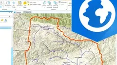
ArcGIS Pro - Arc Hydro for Watershed Management 
Discover the fascinating world of watershed management with the ArcGIS Pro - Arc Hydro for Watershed Management course. This course is designed for ArcGIS Pro users who want to expand their knowledge in hydrology and spatial analysis. Learn how to effectively use the ArcHydro toolbox, understand basin theory, and master the workflow for watershed modeling. With step-by-step instructions and hands-on exercises, you'll gain the skills to delineate watersheds, microwatersheds, and river axes. Plus, the course includes all the necessary data and tools, making it easy to replicate and apply your newfound knowledge. Don't miss this opportunity to enhance your GIS skills and become a watershed management expert. Enroll now! ▼
ADVERTISEMENT
Course Feature
![]() Cost:
Cost:
Paid
![]() Provider:
Provider:
Udemy
![]() Certificate:
Certificate:
Paid Certification
![]() Language:
Language:
English
![]() Start Date:
Start Date:
2022-12-03
Course Overview
❗The content presented here is sourced directly from Udemy platform. For comprehensive course details, including enrollment information, simply click on the 'Go to class' link on our website.
Updated in [September 26th, 2023]
What does this course tell?
(Please note that the following overview content is from the original platform)
Watershed management is one of the most interesting applications of spatial analysis using geographic information systemsFor ArcGIS Pro users this course provides an extension of your knowledge applied to hydrology For this it is as important to understand the use of the tools (ArcHydro toolbox) as the basin theory and the workflow for its modelingSome parts are done using normal ArcGIS Pro tools such as raster functions and spatial analysis with specific application to a work area where it is expected to delineate watersheds microwatersheds and river axes However other specific parts are made with the toolkit that comes with ArcHydro The course teaches how to install ArcHydro and of course how to use the tools for your chosen workflowThe course includes the data used in the exercises so that students can replicate it as well as the raster functions and tools used#AulaGEOThe content of the course is as follows:IntroductionLecture 1: Introduction to GIS hydrologyLecture 2: DEM and flow directionGeoprocessingLecture 3: Geoprocessing analyisis to hydrology functionsLecture 4: Watershed and stream networkAnalyisisLecture 5: Outflows and vector editingUploadLecture 6: Sub-Watershed and area estimationFinal resultsLecture 7: Oerlays slope map visual effects and basinSome parts are done using normal ArcGIS Pro tools such as raster functions and spatial analysis with specific application to a work area where it is expected to delineate watersheds microwatersheds and river axes However other specific parts are made with the toolkit that comes with ArcHydro The course teaches how to install ArcHydro and of course how to use the tools for your chosen workflow
We considered the value of this course from many aspects, and finally summarized it for you from two aspects: skills and knowledge, and the people who benefit from it:
(Please note that our content is optimized through artificial intelligence tools and carefully reviewed by our editorial staff.)
What skills and knowledge will you acquire during this course?During this course, students will acquire the following skills and knowledge:
1. Understanding the use of ArcHydro toolbox: Students will learn how to install ArcHydro and use the tools provided in the toolbox for their chosen workflow in watershed management.
2. Basin theory and workflow modeling: Students will gain knowledge about the theory behind basins and the workflow for modeling watersheds, microwatersheds, and river axes.
3. Use of ArcGIS Pro tools: Students will learn how to use normal ArcGIS Pro tools, such as raster functions and spatial analysis, for delineating watersheds, microwatersheds, and river axes in a specific work area.
4. Geoprocessing analysis for hydrology functions: Students will acquire skills in geoprocessing analysis specifically related to hydrology functions.
5. DEM and flow direction: Students will learn how to work with Digital Elevation Models (DEMs) and flow direction data for hydrological analysis.
6. Watershed and stream network analysis: Students will gain knowledge and skills in analyzing watersheds and stream networks using ArcGIS Pro tools.
7. Outflows and vector editing: Students will learn how to work with outflows and perform vector editing for hydrological analysis.
8. Sub-Watershed and area estimation: Students will acquire skills in delineating sub-watersheds and estimating their areas.
9. Overlays, slope map visual effects, and basin analysis: Students will learn how to perform overlays, create slope maps with visual effects, and analyze basins using the acquired knowledge and tools.
Who will benefit from this course?
This course on ArcGIS Pro - Arc Hydro for Watershed Management will benefit professionals and individuals who are interested in spatial analysis and geographic information systems, specifically in the field of hydrology and watershed management.
1. Hydrologists: Hydrologists who work with GIS and spatial analysis will benefit from this course as it provides an extension of their knowledge in hydrology and teaches them how to use the ArcHydro toolbox for watershed modeling. They will learn about DEM and flow direction, geoprocessing analysis, watershed and stream network analysis, and sub-watershed and area estimation.
2. Environmental Scientists: Environmental scientists involved in watershed management and water resource planning can enhance their skills by taking this course. They will learn how to delineate watersheds, microwatersheds, and river axes using ArcGIS Pro tools and ArcHydro toolkit. This knowledge will help them in analyzing and managing water resources effectively.
3. GIS Professionals: GIS professionals who work in the field of hydrology or watershed management can benefit from this course to expand their knowledge and skills. They will learn how to use ArcHydro tools and techniques for hydrological analysis, such as outflows and vector editing, overlays, slope map visual effects, and basin analysis.
4. Civil Engineers: Civil engineers involved in water resources engineering and planning can benefit from this course as it provides them with the necessary skills to analyze and model watersheds using GIS. They will learn how to use ArcHydro tools for watershed delineation, flow direction analysis, and area estimation, which are essential for designing and managing water infrastructure projects.
5. Researchers and Academics: Researchers and academics in the field of hydrology and watershed management can benefit from this course to enhance their understanding of GIS applications in their research. They will learn about the theory and workflow of watershed modeling using ArcGIS Pro and ArcHydro, which can be applied in their studies and publications.
Course Syllabus
Introduction
Geoprocessing
Analyisis
Final results
Course Provider

Provider Udemy's Stats at AZClass
Discussion and Reviews
0.0 (Based on 0 reviews)
Explore Similar Online Courses

Guide to Import Export for beginners

Ancient Egyptian Mythology 101

Python for Informatics: Exploring Information

Social Network Analysis

Introduction to Systematic Review and Meta-Analysis

The Analytics Edge

DCO042 - Python For Informatics

Causal Diagrams: Draw Your Assumptions Before Your Conclusions

Whole genome sequencing of bacterial genomes - tools and applications
Water Resources - Hydrograph Flow Rate in Hydrology

Hydrology: TSPSC - CIVIL - AEE Polytechnic Lecturer Important Concepts & Questions ACE Online

Start your review of ArcGIS Pro - Arc Hydro for Watershed Management