
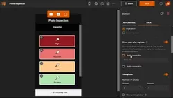
ArcGIS QuickCapture 
ArcGIS QuickCapture is a powerful tool for quickly collecting field observations. It enables users to record data from a moving vehicle, making it ideal for scouting locations, conducting aerial surveys, and assessing damage. The app is easy to use and allows users to quickly send data back to the office for further analysis. ▼
ADVERTISEMENT
Course Feature
![]() Cost:
Cost:
Free
![]() Provider:
Provider:
Youtube
![]() Certificate:
Certificate:
Paid Certification
![]() Language:
Language:
English
![]() Start Date:
Start Date:
On-Demand
Course Overview
❗The content presented here is sourced directly from Youtube platform. For comprehensive course details, including enrollment information, simply click on the 'Go to class' link on our website.
Updated in [February 21st, 2023]
What does this course tell?
(Please note that the following overview content is from the original platform)
ArcGIS QuickCapture is the fastest way to collect field observations. With this simple app, you can quickly record field observations from a moving vehicle while you scout locations, conduct aerial surveys, or assess damage. Send data back to the office for analysis in real time and eliminate time spent manually processing handwritten notes. ArcGIS QuickCapture is integrated with ArcGIS, so new data from the field can be used instantly for better decision-making.
We consider the value of this course from multiple aspects, and finally summarize it for you from three aspects: personal skills, career development, and further study:
(Kindly be aware that our content is optimized by AI tools while also undergoing moderation carefully from our editorial staff.)
1. Improved Efficiency: ArcGIS QuickCapture allows users to quickly record field observations from a moving vehicle, eliminating the need to manually process handwritten notes. This saves time and allows users to send data back to the office for analysis in real time.
2. Improved Accuracy: ArcGIS QuickCapture is integrated with ArcGIS, which allows users to quickly and accurately record field observations. This ensures that data is accurate and can be used for better decision-making.
3. Improved Collaboration: ArcGIS QuickCapture allows users to collaborate with colleagues in the field and in the office. This allows users to share data and collaborate on projects in real time, which improves communication and collaboration.
4. Improved Mobility: ArcGIS QuickCapture is a mobile app, which allows users to record field observations from a moving vehicle. This allows users to be more mobile and flexible, and to quickly and accurately record field observations.
5. Improved Visualization: ArcGIS QuickCapture allows users to visualize data in real time. This allows users to quickly and accurately visualize data, which can be used for better decision-making.
[Applications]
Those who have completed the ArcGIS QuickCapture course can apply their knowledge to quickly and accurately collect field observations from a moving vehicle. This data can then be sent back to the office for analysis in real time, allowing for more efficient decision-making. Additionally, ArcGIS QuickCapture can be used to scout locations, conduct aerial surveys, or assess damage.
[Career Paths]
1. GIS Analyst: GIS Analysts use ArcGIS QuickCapture to collect field observations and analyze data to make informed decisions. They are responsible for creating maps, analyzing spatial data, and developing models to solve complex problems. With the increasing demand for GIS Analysts, the job market is expected to grow significantly in the coming years.
2. GIS Technician: GIS Technicians use ArcGIS QuickCapture to collect field observations and create maps and other visualizations. They are responsible for maintaining and updating GIS databases, performing quality assurance checks, and providing technical support. As the demand for GIS services increases, the job market for GIS Technicians is expected to grow.
3. GIS Developer: GIS Developers use ArcGIS QuickCapture to create custom applications and tools to meet the needs of their organization. They are responsible for developing and maintaining GIS applications, integrating GIS data with other systems, and providing technical support. With the increasing demand for GIS applications, the job market for GIS Developers is expected to grow.
4. GIS Consultant: GIS Consultants use ArcGIS QuickCapture to provide advice and guidance to their clients on how to best use GIS technology. They are responsible for providing technical support, developing GIS solutions, and helping clients make informed decisions. As the demand for GIS services increases, the job market for GIS Consultants is expected to grow.
Course Provider

Provider Youtube's Stats at AZClass
Over 100+ Best Educational YouTube Channels in 2023.
Best educational YouTube channels for college students, including Crash Course, Khan Academy, etc.
AZ Class hope that this free Youtube course can help your ArcGIS skills no matter in career or in further education. Even if you are only slightly interested, you can take ArcGIS QuickCapture course with confidence!
Discussion and Reviews
0.0 (Based on 0 reviews)
Explore Similar Online Courses
Crystal Reports 2016 Essential Training

Beginner Figure Drawing - Introduction to Drawing Clothing and Drapery

Python for Informatics: Exploring Information

Social Network Analysis

Introduction to Systematic Review and Meta-Analysis

The Analytics Edge

DCO042 - Python For Informatics

Causal Diagrams: Draw Your Assumptions Before Your Conclusions

Whole genome sequencing of bacterial genomes - tools and applications
Deep Learning
How to create new shape file and geodatabase in ArcGIS
Start your review of ArcGIS QuickCapture