
ArcGIS Solutions for Emergency Management 
This course provides an overview of ArcGIS Solutions for Emergency Management, which enable organizations to quickly and effectively share and update information in real-time during emergency response. It explores the GIS tools that make this possible. ▼
ADVERTISEMENT
Course Feature
![]() Cost:
Cost:
Free
![]() Provider:
Provider:
Youtube
![]() Certificate:
Certificate:
Paid Certification
![]() Language:
Language:
English
![]() Start Date:
Start Date:
On-Demand
Course Overview
❗The content presented here is sourced directly from Youtube platform. For comprehensive course details, including enrollment information, simply click on the 'Go to class' link on our website.
Updated in [February 21st, 2023]
What does this course tell?
(Please note that the following overview content is from the original platform)
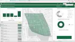
Emergency response requires organizations to share and update information as quickly as possible, sometimes in real-time. See the GIS tools that make it possible.
We consider the value of this course from multiple aspects, and finally summarize it for you from three aspects: personal skills, career development, and further study:
(Kindly be aware that our content is optimized by AI tools while also undergoing moderation carefully from our editorial staff.)
ArcGIS Solutions for Emergency Management is a course that teaches users how to use GIS tools to quickly and effectively share and update information in emergency response situations.
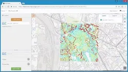
By taking this course, users will gain the knowledge and skills to use GIS tools to help manage emergency situations. They will learn how to create maps and dashboards to visualize data, how to use geocoding to locate people and resources, and how to use analytics to make informed decisions.
Possible development paths for learners include becoming a GIS analyst, a GIS specialist, or a GIS manager. These roles involve using GIS tools to analyze data, create maps, and manage emergency response operations.
Learning suggestions for learners include taking courses in GIS, data analysis, and emergency management. Additionally, learners should familiarize themselves with the different GIS tools available and practice using them in real-world scenarios. They should also stay up to date on the latest GIS technologies and trends.
[Applications]
Participants of the ArcGIS Solutions for Emergency Management course are encouraged to apply the knowledge and skills they have acquired to their own emergency management projects. They can use the GIS tools they have learned to create and share maps, analyze data, and collaborate with other organizations in real-time. Additionally, they can use the ArcGIS platform to create custom applications to support their emergency management operations.
[Career Paths]
1. GIS Analyst: GIS Analysts are responsible for creating, managing, and analyzing geographic data to help organizations make informed decisions. They use GIS software such as ArcGIS to create maps, analyze data, and develop models to help visualize and interpret data. GIS Analysts are in high demand as the use of GIS technology continues to grow in the emergency management field.
2. Emergency Management Coordinator: Emergency Management Coordinators are responsible for developing and implementing emergency management plans and procedures. They use GIS technology to create maps and analyze data to help identify potential risks and develop strategies to mitigate them. They also coordinate with other agencies and organizations to ensure that emergency plans are up to date and effective.
3. Disaster Response Manager: Disaster Response Managers are responsible for leading and coordinating disaster response efforts. They use GIS technology to create maps and analyze data to help identify areas of need and develop strategies to respond to disasters. They also coordinate with other agencies and organizations to ensure that response efforts are effective and efficient.
4. GIS Developer: GIS Developers are responsible for developing and maintaining GIS applications and systems. They use GIS software such as ArcGIS to create custom applications and systems to help organizations manage and analyze geographic data. GIS Developers are in high demand as the use of GIS technology continues to grow in the emergency management field.
Course Provider

Provider Youtube's Stats at AZClass
Over 100+ Best Educational YouTube Channels in 2023.
Best educational YouTube channels for college students, including Crash Course, Khan Academy, etc.
AZ Class hope that this free Youtube course can help your ArcGIS skills no matter in career or in further education. Even if you are only slightly interested, you can take ArcGIS Solutions for Emergency Management course with confidence!
Discussion and Reviews
0.0 (Based on 0 reviews)
Explore Similar Online Courses

GCSE Psychology for AQA specification

Fundamentals of Notion: Supercharge Your Productivity

Python for Informatics: Exploring Information

Social Network Analysis

Introduction to Systematic Review and Meta-Analysis

The Analytics Edge

DCO042 - Python For Informatics

Causal Diagrams: Draw Your Assumptions Before Your Conclusions

Whole genome sequencing of bacterial genomes - tools and applications

Deep Learning
How to create new shape file and geodatabase in ArcGIS
Start your review of ArcGIS Solutions for Emergency Management