
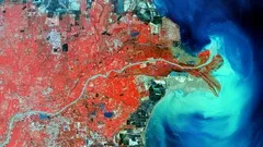
Complete Remote Sensing Image Analysis with ENVI Software 
Delve into remote sensing image analysis using ENVI software. Learn to extract valuable insights from satellite imagery. #RemoteSensing #ENVI #SatelliteImagery ▼
ADVERTISEMENT
Course Feature
![]() Cost:
Cost:
Paid
![]() Provider:
Provider:
Udemy
![]() Certificate:
Certificate:
Paid Certification
![]() Language:
Language:
English
![]() Start Date:
Start Date:
2020-11-03
Course Overview
❗The content presented here is sourced directly from Udemy platform. For comprehensive course details, including enrollment information, simply click on the 'Go to class' link on our website.
Updated in [August 21st, 2023]
What skills and knowledge will you acquire during this course?
By taking this course, you will acquire the skills and knowledge to carry out practical and real-life remote sensing image analysis processes using ENVI software. You will learn how to navigate the software and use basic tools in ENVI. Additionally, you will learn fundamental techniques in satellite remote sensing image processing, such as image mosaicing, radiometric calibration, multiple atmospheric correction techniques, supervised and unsupervised classification, vegetation indices, and band ratios. You will also gain proficiency in intermediate and advanced ENVI remote sensing processes, including hyperspectral data analysis, image registration, anomaly detection, creating a burn index map, mineral mapping from hyperspectral images, spectral angle mapping, time series analysis, and pansharpening. Furthermore, you will learn how to locate and download free remote sensing satellite images. This course will provide you with hands-on experience using actual images and data from popular satellites, as well as additional resources for your future remote sensing career.
How does this course contribute to professional growth?
This course contributes to professional growth by providing a complete foundation in remote sensing image analysis using ENVI software. It allows individuals to gain proficiency in remote sensing data analysis, which is highly valued in industry and research positions. The course covers a wide range of techniques and processes, from basic tools and navigation in ENVI to intermediate and advanced processes such as hyperspectral data analysis and time series analysis. By completing this course, individuals will have the skills and knowledge necessary to carry out practical and real-life remote sensing image analysis tasks, making them more competitive in the field of remote sensing and enhancing their professional growth.
Is this course suitable for preparing further education?
Yes, this course is suitable for preparing further education.
Course Syllabus
Introduction and Sample Data
Basic ENVI Tools
Atmospheric Corrections
Fundamental ENVI Remote Sensing Processes
Example Project
Intermediate and Advanced ENVI Processes
Classification (Intermediate/Advanced)
Hyperspectral Analysis
Making a Satellite Image Basemap for MapTiler
Course Provider

Provider Udemy's Stats at AZClass
Discussion and Reviews
0.0 (Based on 0 reviews)
Explore Similar Online Courses

Machine Learning in GIS : Understand the Theory and Practice

Geospatial Analyses & Remote Sensing : from Beginner to Pro

Python for Informatics: Exploring Information

Social Network Analysis

Introduction to Systematic Review and Meta-Analysis
The Analytics Edge

DCO042 - Python For Informatics

Causal Diagrams: Draw Your Assumptions Before Your Conclusions
Whole genome sequencing of bacterial genomes - tools and applications
Introduction to GIS
Enterprise Geodatabases & Data Pipelines

Start your review of Complete Remote Sensing Image Analysis with ENVI Software