Endangered Archaeology: Using Remote Sensing to Protect Cultural Heritage 
This Durham University course provides an introduction to the use of remote sensing to protect cultural heritage in the Middle East and North Africa. Students will learn how to identify and assess archaeological sites using satellite imagery. ▼
ADVERTISEMENT
Course Feature
![]() Cost:
Cost:
Free
![]() Provider:
Provider:
Futurelearn
![]() Certificate:
Certificate:
No Information
![]() Language:
Language:
English
Course Overview
❗The content presented here is sourced directly from Futurelearn platform. For comprehensive course details, including enrollment information, simply click on the 'Go to class' link on our website.
Updated in [March 06th, 2023]
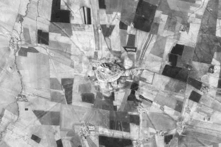
This course provides an introduction to the use of remote sensing to protect cultural heritage. Students will learn how to use free satellite imaging platforms such as Google Earth Pro to perform basic remote sensing tasks. They will also gain an understanding of the fundamental archaeological processes that influence site formation.
Using satellite imagery, students will learn how to identify a variety of archaeological sites. They will also learn how to use remote sensing techniques to assess threats and damages to heritage sites. Finally, students will learn how to make maps with Google Earth Pro.
By the end of the course, students will have a better understanding of the use of remote sensing to protect cultural heritage. They will be able to identify archaeological sites using satellite imagery and assess threats and damages to heritage sites. They will also be able to make maps with Google Earth Pro.
This course is designed for students who are interested in learning about the use of remote sensing to protect cultural heritage. It is suitable for students with a basic understanding of archaeology and remote sensing. No prior experience with Google Earth Pro is required.
[Applications]
The application of this course can be used to help protect cultural heritage sites. Participants can use the free satellite imaging platforms like Google Earth Pro to perform basic remote sensing tasks, such as determining the fundamental archaeological processes that influence site formation, identifying a variety of archaeological sites, and assessing threats and damages to heritage sites. Additionally, participants can use Google Earth Pro to make maps. This course can be used to help protect cultural heritage sites from destruction and ensure that they are preserved for future generations.
[Career Paths]
1. Archaeological Site Manager: Archaeological site managers are responsible for the preservation and protection of archaeological sites. They work with local governments, organizations, and communities to ensure that archaeological sites are protected from damage and destruction. They also work to educate the public about the importance of preserving archaeological sites. As the demand for archaeological sites increases, the need for archaeological site managers is expected to grow.
2. Archaeological Technician: Archaeological technicians are responsible for the collection and analysis of archaeological data. They use a variety of methods, including remote sensing, to identify and document archaeological sites. They also use remote sensing to assess threats and damages to heritage sites. As the demand for archaeological data increases, the need for archaeological technicians is expected to grow.
3. Archaeological Educator: Archaeological educators are responsible for educating the public about the importance of preserving archaeological sites. They use a variety of methods, including remote sensing, to teach the public about the history and significance of archaeological sites. As the demand for archaeological education increases, the need for archaeological educators is expected to grow.
4. Archaeological Researcher: Archaeological researchers are responsible for conducting research on archaeological sites. They use a variety of methods, including remote sensing, to identify and document archaeological sites. They also use remote sensing to assess threats and damages to heritage sites. As the demand for archaeological research increases, the need for archaeological researchers is expected to grow.
[Education Paths]
1. Archaeology Degree: An Archaeology degree is a great way to learn about the history of human cultures and the development of civilizations. It is a multidisciplinary field that combines elements of anthropology, history, geology, and other sciences. Students will learn about the methods and techniques used to uncover and analyze archaeological sites, as well as the ethical considerations of working with cultural heritage. With the increasing use of remote sensing technology, students will also gain an understanding of how to use satellite imagery to identify and protect archaeological sites.
2. Geography Degree: A Geography degree is a great way to learn about the physical and human aspects of the environment. Students will learn about the physical processes that shape the Earth’s surface, as well as the human activities that impact the environment. With the increasing use of remote sensing technology, students will also gain an understanding of how to use satellite imagery to identify and protect archaeological sites.
3. Environmental Science Degree: An Environmental Science degree is a great way to learn about the natural environment and the impact of human activities on it. Students will learn about the physical processes that shape the Earth’s surface, as well as the human activities that impact the environment. With the increasing use of remote sensing technology, students will also gain an understanding of how to use satellite imagery to identify and protect archaeological sites.
4. Computer Science Degree: A Computer Science degree is a great way to learn about the technology used to analyze and interpret satellite imagery. Students will learn about the algorithms and software used to process and analyze satellite data, as well as the ethical considerations of working with cultural heritage. With the increasing use of remote sensing technology, students will also gain an understanding of how to use satellite imagery to identify and protect archaeological sites.
Course Syllabus
Using satellite imagery for archaeology
Seeing archaeology
Seeing damage
Landscapes of mud
Landscapes of stone
Communicating information: making maps
Course Provider

Provider Futurelearn's Stats at AZClass
Discussion and Reviews
0.0 (Based on 0 reviews)
Explore Similar Online Courses

Word Quick Tips Online Class

Step Up Your JS: A Comprehensive Guide to Intermediate JavaScript

Python for Informatics: Exploring Information

Social Network Analysis

Introduction to Systematic Review and Meta-Analysis

The Analytics Edge

DCO042 - Python For Informatics

Causal Diagrams: Draw Your Assumptions Before Your Conclusions

Whole genome sequencing of bacterial genomes - tools and applications

Curanderismo: Traditional Healing Using Plants

Storytelling in Branding and Content Marketing

The Modern World Part Two: Global History since 1910
 Related Categories
 Popular Providers
Quiz
 Submitted Sucessfully
1. What is the main purpose of this course?
2. Which of the following is not a part of this course?
3. Which of the following is a free satellite imaging platform?
4. What is Google Earth Pro?
Correct Answer: It is a free satellite imaging platform.


Start your review of Endangered Archaeology: Using Remote Sensing to Protect Cultural Heritage