
Groundwater Potential Zones GIS - Complete Project ArcGIS 
Discover the world of groundwater potential zones through a complete project in ArcGIS. #Groundwater #GISProject #ArcGIS ▼
ADVERTISEMENT
Course Feature
![]() Cost:
Cost:
Paid
![]() Provider:
Provider:
Udemy
![]() Certificate:
Certificate:
Paid Certification
![]() Language:
Language:
English
![]() Start Date:
Start Date:
2023-02-23
Course Overview
❗The content presented here is sourced directly from Udemy platform. For comprehensive course details, including enrollment information, simply click on the 'Go to class' link on our website.
Updated in [August 21st, 2023]
What skills and knowledge will you acquire during this course?
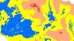
During this course, you will acquire the skills and knowledge to perform a complete project using ArcGIS for groundwater potential zone analysis. The course covers everything from downloading and processing data from Google Search to generating final results. It also includes the use of online data sources to prepare groundwater data. The course covers all practical aspects of the project, starting from the basics. You will not need to leave your room to run this project, as everything can be done using GIS. However, if you have observation data, you can also generate a fluctuation map, which is an optional part of the project. The course also teaches you how to generate groundwater maps without groundwater data, although this data is not easily available. The course also covers other analyses such as flood risk and drought-prone area analysis, as the same data can be used for these purposes. You will also learn data plotting and watershed delineations, although if your study area is not a watershed, you can use the study area boundary instead. The course also covers more advanced tasks in GIS, such as DEM mosaic, data re-projecting, cutting of study area, and soil map generation. Overall, this course is a complete project from scratch and assumes that you have a basic understanding of GIS.
How does this course contribute to professional growth?
This course on Groundwater Potential Zones GIS - Complete Project ArcGIS contributes to professional growth by providing comprehensive training on various aspects of groundwater analysis using GIS. It covers everything from basic to final results, starting from data download and processing to the generation of groundwater maps. The course also teaches the use of available online data sources for preparing groundwater analysis. Additionally, it covers practical aspects such as data plotting, watershed delineations, and other advanced tasks of GIS. By taking this course, professionals not only learn about groundwater analysis but also gain expertise in various advanced GIS techniques. It is recommended for individuals with a basic understanding of GIS.
Is this course suitable for preparing further education?
Yes, this course is suitable for preparing further education.
Course Syllabus
Introduction
Dem Preparation
Watershed Delineation
Study Area Preparation
Generation of Required Surface Datasets
Rainfall Map Preparation
Data Arrangement and Soil Data Preparation
Data Reclassification
Performing Groundwater Analysis
Flood Risk and Drought from same data
Groundwater Fluctuation from Observed data
Tips for Better Analysis
Expired Videos
What is next
Course Provider

Provider Udemy's Stats at AZClass
Discussion and Reviews
0.0 (Based on 0 reviews)
Explore Similar Online Courses
Geospatial Analyses & Remote Sensing : from Beginner to Pro

Geospatial Data Science with Python: GeoPandas

Python for Informatics: Exploring Information

Social Network Analysis

Introduction to Systematic Review and Meta-Analysis
The Analytics Edge

DCO042 - Python For Informatics

Causal Diagrams: Draw Your Assumptions Before Your Conclusions
Whole genome sequencing of bacterial genomes - tools and applications
Introduction to GIS
Enterprise Geodatabases & Data Pipelines
Start your review of Groundwater Potential Zones GIS - Complete Project ArcGIS