
Site Scan for ArcGIS 
Site Scan for ArcGIS is a comprehensive SaaS solution for drone imagery. It provides users with flight planning, data collection, cloud processing, and first phase analysis capabilities, all seamlessly integrated with ArcGIS Online and ArcGIS Enterprise. This end-to-end solution enables users to quickly and easily capture, analyze, and share drone data. ▼
ADVERTISEMENT
Course Feature
![]() Cost:
Cost:
Free
![]() Provider:
Provider:
Youtube
![]() Certificate:
Certificate:
Paid Certification
![]() Language:
Language:
English
![]() Start Date:
Start Date:
On-Demand
Course Overview
❗The content presented here is sourced directly from Youtube platform. For comprehensive course details, including enrollment information, simply click on the 'Go to class' link on our website.
Updated in [February 21st, 2023]
What does this course tell?
(Please note that the following overview content is from the original platform)
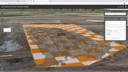
Site Scan for ArcGIS is a SaaS offering for flight planning, data collection, cloud processing, and first phase analysis of drone imagery, seamlessly integrated with ArcGIS Online and ArcGIS Enterprise to deliver an end-to-end solution for drone imaging, mapping, planning, inspection, and monitoring projects.
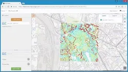
Site Scan includes a variety of intuitive tools for site analysis as well as project reporting, and the integrated fleet management capabilities ensure proper record keeping for your drone hardware and flight crews.
We consider the value of this course from multiple aspects, and finally summarize it for you from three aspects: personal skills, career development, and further study:
(Kindly be aware that our content is optimized by AI tools while also undergoing moderation carefully from our editorial staff.)
Learners can learn how to use Site Scan for ArcGIS to plan and execute drone imaging, mapping, and monitoring projects. They can learn how to use the intuitive tools for site analysis and project reporting, as well as how to use the integrated fleet management capabilities to ensure proper record keeping for their drone hardware and flight crews. Additionally, learners can learn how to use the cloud processing and first phase analysis of drone imagery, and how to integrate Site Scan with ArcGIS Online and ArcGIS Enterprise to deliver an end-to-end solution.
[Applications]
Users of Site Scan for ArcGIS can apply the knowledge they have gained to plan and execute drone imaging, mapping, planning, inspection, and monitoring projects. They can also use the intuitive tools for site analysis and project reporting, as well as the integrated fleet management capabilities to ensure proper record keeping for their drone hardware and flight crews. Additionally, users can take advantage of the seamless integration with ArcGIS Online and ArcGIS Enterprise to deliver an end-to-end solution for their projects.
[Career Paths]
1. Drone Pilot: Drone Pilots are responsible for operating drones to capture aerial imagery and data for mapping, inspection, and monitoring projects. They must be knowledgeable in the operation of drones, flight planning, and data collection. As the use of drones for mapping and inspection projects continues to grow, the demand for experienced Drone Pilots is expected to increase.
2. GIS Analyst: GIS Analysts are responsible for analyzing and interpreting drone imagery and data collected by Drone Pilots. They must be knowledgeable in the use of GIS software, such as ArcGIS, to create maps, analyze data, and generate reports. As the use of drones for mapping and inspection projects continues to grow, the demand for experienced GIS Analysts is expected to increase.
3. Drone Program Manager: Drone Program Managers are responsible for managing the overall drone program, including the selection and maintenance of drone hardware, the training of Drone Pilots, and the analysis of drone data. They must be knowledgeable in the operation of drones, flight planning, data collection, and GIS software. As the use of drones for mapping and inspection projects continues to grow, the demand for experienced Drone Program Managers is expected to increase.
4. Drone Data Scientist: Drone Data Scientists are responsible for analyzing and interpreting large amounts of drone data collected by Drone Pilots. They must be knowledgeable in the use of GIS software, such as ArcGIS, as well as data science techniques, such as machine learning and artificial intelligence. As the use of drones for mapping and inspection projects continues to grow, the demand for experienced Drone Data Scientists is expected to increase.
Course Provider

Provider Youtube's Stats at AZClass
Over 100+ Best Educational YouTube Channels in 2023.
Best educational YouTube channels for college students, including Crash Course, Khan Academy, etc.
AZ Class hope that this free Youtube course can help your ArcGIS skills no matter in career or in further education. Even if you are only slightly interested, you can take Site Scan for ArcGIS course with confidence!
Discussion and Reviews
0.0 (Based on 0 reviews)
Explore Similar Online Courses

Illustrated Words & Monograms: Paint and Print Techniques (for Wall Art and Greetings Cards)

Learn English Tense In Bengali Version

Python for Informatics: Exploring Information

Social Network Analysis

Introduction to Systematic Review and Meta-Analysis

The Analytics Edge

DCO042 - Python For Informatics

Causal Diagrams: Draw Your Assumptions Before Your Conclusions

Whole genome sequencing of bacterial genomes - tools and applications
Deep Learning
How to create new shape file and geodatabase in ArcGIS
Start your review of Site Scan for ArcGIS