
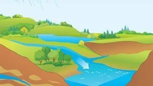
Basic Hydrology 
Learn how to create hydrologic models of small watersheds for conservation and stormwater management structures in this comprehensive course on Basic Hydrology. Designed for soil and water district technicians and junior engineers, this course covers three widely used hydrology models: EFH2, TR-20&TR-55, and the rational method. With a blend of GIS and by-hand analysis methods, you'll learn how to compute peak runoff rates for both rural and urban watersheds, delineate watersheds using maps and ground truthing, and understand the differences between the models. Don't miss out on this opportunity to enhance your skills and make a positive impact on water conservation. Enroll now! ▼
ADVERTISEMENT
Course Feature
![]() Cost:
Cost:
Free
![]() Provider:
Provider:
Udemy
![]() Certificate:
Certificate:
No Information
![]() Language:
Language:
English
![]() Start Date:
Start Date:
On-Demand
Course Overview
❗The content presented here is sourced directly from Udemy platform. For comprehensive course details, including enrollment information, simply click on the 'Go to class' link on our website.
Updated in [September 26th, 2023]
What does this course tell?
(Please note that the following overview content is from the original platform)
Creating hydrologic models of small watersheds for conservation bmps leveraging the power of GIS
What youll learn:
Compute peak runoff rates for rural watersheds
Compute peak runoff rates for urban watersheds
Delineate watersheds using maps and ground truthing
Understand the differences between the 3 most widely used hydrology models
This course teaches soil and water district technicians and junior engineers how to model small watersheds for conservation and stormwater management structures Three hydrological models are presented: EFH2 TR-20&TR-55 and the rational method The course includes a blend of GIS and by-hand analysis methods For the GIS portions parallel workflows are presented for ArcGIS (Spatial Analyst extension) and for QGIS The EFH2 software is presented for rural hydrology while HydroCAD (Free Sampler edition) is used for urban projects The course culminates in two design examples to allow students to implement what theyve learned
We considered the value of this course from many aspects, and finally summarized it for you from two aspects: skills and knowledge, and the people who benefit from it:
(Please note that our content is optimized through artificial intelligence tools and carefully reviewed by our editorial staff.)
What skills and knowledge will you acquire during this course?During this course, participants will acquire the following skills and knowledge:
1. Computing peak runoff rates for rural watersheds: Participants will learn how to calculate the maximum amount of water that can flow out of a rural watershed during a storm event.
2. Computing peak runoff rates for urban watersheds: Participants will learn how to calculate the maximum amount of water that can flow out of an urban watershed during a storm event, taking into account the impact of impervious surfaces.
3. Delineating watersheds using maps and ground truthing: Participants will learn how to identify and delineate the boundaries of watersheds using both maps and on-site observations.
4. Understanding the differences between the three most widely used hydrology models: Participants will gain a comprehensive understanding of the EFH2, TR-20&TR-55, and rational method hydrology models, including their strengths, weaknesses, and appropriate applications.
5. Creating hydrologic models using GIS: Participants will learn how to leverage the power of Geographic Information Systems (GIS) to create hydrologic models of small watersheds. Parallel workflows will be presented for both ArcGIS (with the Spatial Analyst extension) and QGIS.
6. Utilizing EFH2 and HydroCAD software: Participants will be introduced to the EFH2 software for rural hydrology modeling and the HydroCAD (Free Sampler edition) software for urban projects.
7. Implementing conservation and stormwater management structures: The course will culminate in two design examples, allowing participants to apply their newly acquired skills and knowledge to design and implement conservation and stormwater management structures in small watersheds.
Who will benefit from this course?
This course will benefit soil and water district technicians and junior engineers who are involved in modeling small watersheds for conservation and stormwater management structures. Specifically, individuals who are interested in hydrology and want to learn how to create hydrologic models of small watersheds using GIS will find this course valuable.
The course is designed to teach participants how to compute peak runoff rates for both rural and urban watersheds. It also covers the process of delineating watersheds using maps and ground truthing. Additionally, the course focuses on the three most widely used hydrology models: EFH2, TR-20&TR-55, and the rational method.
The course includes a combination of GIS and by-hand analysis methods. For the GIS portions, parallel workflows are presented for both ArcGIS (Spatial Analyst extension) and QGIS. Participants will also learn how to use specific software such as EFH2 for rural hydrology and HydroCAD (Free Sampler edition) for urban projects.
Course Provider

Provider Udemy's Stats at AZClass
Discussion and Reviews
0.0 (Based on 0 reviews)
Explore Similar Online Courses

Business Application of Machine Learning and Artificial Intelligence in Healthcare

Beyond the Logo: Crafting a Brand Identity

Python for Informatics: Exploring Information

Social Network Analysis

Introduction to Systematic Review and Meta-Analysis

The Analytics Edge

DCO042 - Python For Informatics

Causal Diagrams: Draw Your Assumptions Before Your Conclusions
Whole genome sequencing of bacterial genomes - tools and applications
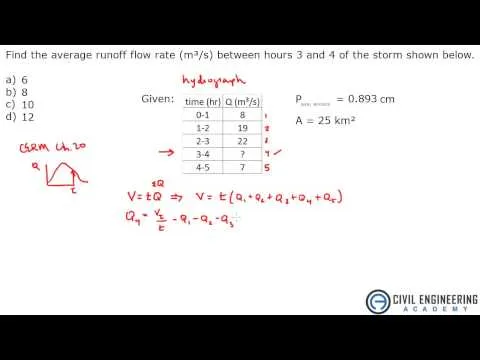
Water Resources - Hydrograph Flow Rate in Hydrology

Hydrology: TSPSC - CIVIL - AEE Polytechnic Lecturer Important Concepts & Questions ACE Online
Start your review of Basic Hydrology