

Introduction to Surveying: Field to Finish in AutoCAD Civil 3D 
This course provides an introduction to the tools and techniques used in the "Field to Finish" process of surveying and mapping with AutoCAD Civil 3D. Participants will learn how to automate and optimize their workflow for maximum efficiency. ▼
ADVERTISEMENT
Course Feature
![]() Cost:
Cost:
Free Trial
![]() Provider:
Provider:
Pluralsight
![]() Certificate:
Certificate:
No Information
![]() Language:
Language:
English
![]() Start Date:
Start Date:
Self Paced
Course Overview
❗The content presented here is sourced directly from Pluralsight platform. For comprehensive course details, including enrollment information, simply click on the 'Go to class' link on our website.
Updated in [March 06th, 2023]
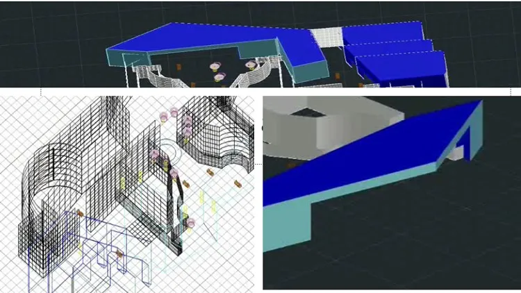
This course, Introduction to Surveying: Field to Finish in AutoCAD Civil 3D, provides an overview of the survey workflow in Civil 3D. Participants will learn about survey objects and databases, explore the portions of the Civil 3D user interface that are specific to Survey workflows, and dig into the Survey Settings. Additionally, participants will learn how to use Description Keys to control the look of points and their layers based on their Raw Description codes.
[Applications]
After completing this course, students can apply their knowledge to create survey drawings in AutoCAD Civil 3D. They can use the survey objects and databases to create points, lines, and curves. They can also use the Survey Settings to control the look of points and their layers based on their Raw Description codes. Additionally, they can use Description Keys to control the look of points and their layers based on their Raw Description codes.
[Career Paths]
1. Surveyor: Surveyors are responsible for collecting and analyzing data to determine the precise location of natural and man-made features on the earth's surface. They use a variety of tools and techniques, such as aerial photography, GPS, and GIS, to measure and map the land. With the development of new technologies, surveyors are increasingly using drones and 3D scanning to collect data.
2. GIS Analyst: GIS Analysts use geographic information systems (GIS) to analyze and interpret data. They create maps and other visualizations to help organizations make informed decisions. GIS Analysts are also responsible for maintaining and updating GIS databases, as well as developing new applications and tools to improve the accuracy and efficiency of GIS data.
3. Civil Engineer: Civil Engineers are responsible for designing, constructing, and maintaining infrastructure projects such as roads, bridges, and buildings. They use AutoCAD Civil 3D to create detailed plans and drawings for these projects, and use survey data to ensure accuracy. With the development of new technologies, Civil Engineers are increasingly using drones and 3D scanning to collect data.
4. Landscape Architect: Landscape Architects are responsible for designing outdoor spaces such as parks, gardens, and public spaces. They use AutoCAD Civil 3D to create detailed plans and drawings for these projects, and use survey data to ensure accuracy. With the development of new technologies, Landscape Architects are increasingly using drones and 3D scanning to collect data.
[Education Paths]
1. Bachelor of Science in Civil Engineering: This degree path focuses on the design, construction, and maintenance of physical and naturally-built environments, such as roads, bridges, and buildings. It also covers topics such as surveying, geotechnical engineering, and structural engineering. Developing trends in this field include the use of advanced technologies such as AutoCAD Civil 3D to improve the accuracy and efficiency of surveying and engineering projects.
2. Bachelor of Science in Geomatics Engineering: This degree path focuses on the use of geospatial technologies to measure, analyze, and manage the Earth's surface. It covers topics such as remote sensing, geographic information systems (GIS), and global positioning systems (GPS). Developing trends in this field include the use of advanced technologies such as AutoCAD Civil 3D to improve the accuracy and efficiency of surveying and engineering projects.
3. Bachelor of Science in Land Surveying: This degree path focuses on the measurement and mapping of land and other physical features. It covers topics such as boundary law, topography, and photogrammetry. Developing trends in this field include the use of advanced technologies such as AutoCAD Civil 3D to improve the accuracy and efficiency of surveying and engineering projects.
4. Bachelor of Science in Geographic Information Science: This degree path focuses on the use of geospatial technologies to analyze and manage geographic data. It covers topics such as remote sensing, GIS, and GPS. Developing trends in this field include the use of advanced technologies such as AutoCAD Civil 3D to improve the accuracy and efficiency of surveying and engineering projects.
Course Provider

Provider Pluralsight's Stats at AZClass
Pluralsight ranked 16th on the Best Medium Workplaces List.
Pluralsight ranked 20th on the Forbes Cloud 100 list of the top 100 private cloud companies in the world.
Pluralsight Ranked on the Best Workplaces for Women List for the second consecutive year.
AZ Class hope that this free trial Pluralsight course can help your AutoCAD skills no matter in career or in further education. Even if you are only slightly interested, you can take Introduction to Surveying: Field to Finish in AutoCAD Civil 3D course with confidence!
31,000 Learners
7,000 Courses
Discussion and Reviews
0.0 (Based on 0 reviews)
Explore Similar Online Courses

Learning Graphic Design History

Elixir and Phoenix Real World Functional Programming

Python for Informatics: Exploring Information

Social Network Analysis

Introduction to Systematic Review and Meta-Analysis

The Analytics Edge

DCO042 - Python For Informatics

Causal Diagrams: Draw Your Assumptions Before Your Conclusions

Whole genome sequencing of bacterial genomes - tools and applications
Learn Autocad basics from projects

AutoCAD Basic Commands for Beginners with practical Approach
Start your review of Introduction to Surveying: Field to Finish in AutoCAD Civil 3D