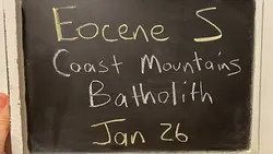
Eocene S - Coast Mountains Batholith w& Robinson Cecil 
Robinson Cecil presents a lecture on the Coast Mountains Batholith, a large geological formation in the Eocene period. He explains how the CMB was formed through subduction or slab failure, and how magmatic flare ups, IMS and INS boundaries, and the North Cascades are all part of the CMB. He also discusses the size and scope of the formation. ▼
ADVERTISEMENT
Course Feature
![]() Cost:
Cost:
Free
![]() Provider:
Provider:
Youtube
![]() Certificate:
Certificate:
Paid Certification
![]() Language:
Language:
English
![]() Start Date:
Start Date:
On-Demand
Course Overview
❗The content presented here is sourced directly from Youtube platform. For comprehensive course details, including enrollment information, simply click on the 'Go to class' link on our website.
Updated in [February 21st, 2023]
This course provides an overview of the Eocene S - Coast Mountains Batholith (CMB) and Robinson Cecil. The lecture will begin with a video start and a lecture start. The lecture will cover topics such as the schedule and Eocene papers, subduction or slab failure, magmatic flare ups, IMS and INS boundary, North Cascades being part of the CMB, Robinson Cecil, the size of the CMB, isotopes of magmatic flare ups, Sierra Nevada flare ups, melting the mantle, Central Gneiss Complex exhumation, Baja BC, restoring the batholith, Eocene pluton, and future research. There will also be a Q&A session and a recap and connections to previous sessions. The course will conclude with a toast and goodbye.
[Applications]
The application of this course can be seen in the study of the Eocene S - Coast Mountains Batholith w& Robinson Cecil. It can be used to understand the subduction or slab failure, magmatic flare ups, IMS and INS boundary, North Cascades, Robinson Cecil, isotopes of magmatic flare ups, Sierra Nevada flare ups, melting the mantle, Central Gneiss Complex Exhumation, Baja BC, restoring the batholith, Eocene Pluton, and future research. Additionally, this course can be used to make connections to previous sessions and to provide a recap of the material covered.
[Career Paths]
1. Geologist: Geologists study the physical structure and composition of the Earth, including its rocks, minerals, and other materials. They use their knowledge to explore for natural resources, such as oil and gas, and to assess the environmental impact of human activities. The demand for geologists is expected to grow as the need for energy and natural resources increases.
2. Geophysicist: Geophysicists use physical principles to study the Earth's structure and composition. They use seismic, magnetic, and gravity data to map the Earth's interior and to study the Earth's atmosphere, oceans, and landforms. Geophysicists are in high demand as the need for energy and natural resources increases.
3. Petroleum Engineer: Petroleum engineers design and develop methods for extracting oil and gas from the Earth. They use their knowledge of geology, chemistry, and physics to develop new technologies and techniques for extracting and refining oil and gas. The demand for petroleum engineers is expected to grow as the need for energy and natural resources increases.
4. Environmental Scientist: Environmental scientists study the effects of human activities on the environment. They use their knowledge of geology, chemistry, and biology to assess the impact of pollution, climate change, and other environmental issues. The demand for environmental scientists is expected to grow as the need for sustainable development increases.
[Education Paths]
1. Geology: Geology is the study of the Earth, its composition, structure, and history. It is a rapidly developing field, with new technologies and techniques being developed all the time. Geologists study the Earth’s surface, its interior, and the processes that shape it. They use a variety of tools, including field mapping, geophysical surveys, and laboratory analysis. Geologists can specialize in areas such as mineralogy, petrology, geochemistry, and paleontology.
2. Geophysics: Geophysics is the study of the physical properties of the Earth and its environment. It is a multidisciplinary field, combining elements of physics, mathematics, and geology. Geophysicists use a variety of techniques to study the Earth’s structure, composition, and dynamics. They use seismic, gravity, and magnetic surveys to map the Earth’s interior, and use remote sensing to study the Earth’s surface.
3. Geochemistry: Geochemistry is the study of the chemical composition of the Earth and its environment. It is a multidisciplinary field, combining elements of chemistry, physics, and geology. Geochemists use a variety of techniques to study the Earth’s composition, including spectroscopy, isotope analysis, and X-ray diffraction. They use these techniques to study the Earth’s surface, its interior, and the processes that shape it.
4. Geomatics: Geomatics is the study of the measurement and representation of the Earth’s surface. It is a rapidly developing field, with new technologies and techniques being developed all the time. Geomatics combines elements of surveying, mapping, and computer science. Geomatics professionals use a variety of tools, including GPS, GIS, and remote sensing, to measure and map the Earth’s surface. They use these tools to create detailed maps and 3D models of the Earth’s surface.
Course Provider

Provider Youtube's Stats at AZClass
Discussion and Reviews
0.0 (Based on 0 reviews)
Explore Similar Online Courses

RAVEN Dream Sequence - Memory Consolidation and Insight Extraction for AGI or cognitive architecture

Beads Baubles & Jewels: The Art of Jewelry

Python for Informatics: Exploring Information

Social Network Analysis

Introduction to Systematic Review and Meta-Analysis

The Analytics Edge

DCO042 - Python For Informatics

Causal Diagrams: Draw Your Assumptions Before Your Conclusions

Whole genome sequencing of bacterial genomes - tools and applications

Mining Engineering

The Future of Mining?


Start your review of Eocene S - Coast Mountains Batholith w& Robinson Cecil